Research
We study the large-scale evolution of coastal environments with an emphasis on the effects of environmental change and management on barrier coastlines.
Coupled human natural dynamics
on barrier island coastlines
Developed coastal landscapes are shaped by interactions between human activities and natural processes. Storms and other natural processes that create, maintain, and reshape coastal environments impact coastal communities as hazards. Management actions taken to reduce hazards may generate near-term benefits to communities, but they can be counterproductive in the long term, leading to increased community and ecosystem vulnerability in future decades. Understanding the dynamics associated with this coupled-human-natural coastal system is the focus of much of our work in CECL.
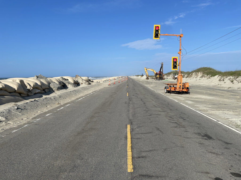
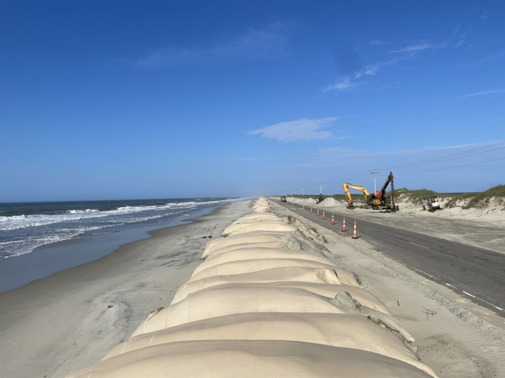
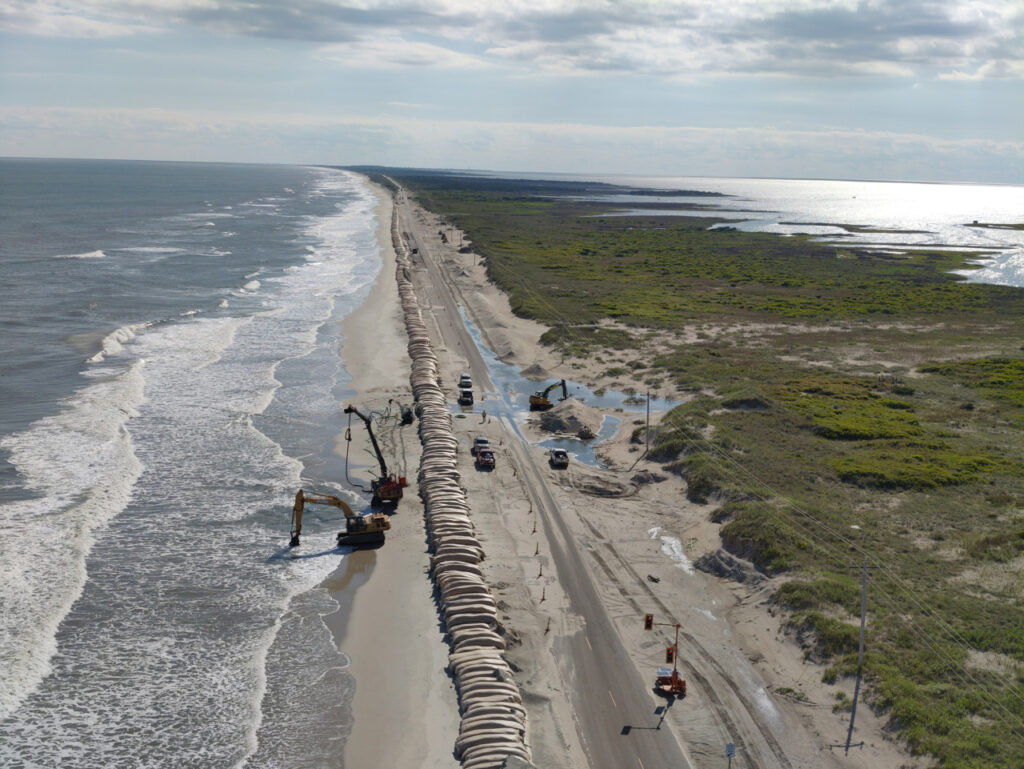
Evaluating the effects of roadway management strategies on Ocracoke Island
The overall goal of this project is to provide science-based assessments of future landscape change under different management and climate change scenarios. These assessments are designed to contribute to decision-making processes as Cape Hatteras National Seashore, North Carolina Department of Transportation, Hyde County and the Village of Ocracoke work to address transportation and resource management challenges on Ocracoke Island as well as access to and from Hatteras Island. (Funded by the National Park Service)


Project Summary
There is a need to develop new ways for communities and stakeholders to evaluate the effects of near-term decisions on long-term community and ecosystem resilience. This is critical because decisions made to solve problems in the short-term can be unintentionally counter-productive in the long-term, producing outcomes that can inadvertently limit the habitability of coastal landscapes.
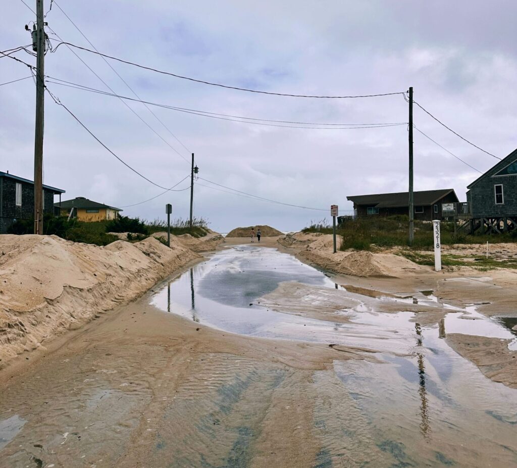
Coastal communities are already feeling the negative effects of changing conditions with severe storm impacts becoming more extreme and coastal erosion hotspots becoming more difficult to address in recent years. Climate change will continue to amplify these challenges by increasing hurricane longevity, intensity, and rainfall. Meanwhile, chronic hazards, including high-tide flooding and shoreline erosion will only worsen in the future, with at least one foot of sea-level rise expected to occur by 2050. The long-term habitability, accessibility, and utility of barrier islands in NC and beyond will depend on the management strategies that are selected and implemented in the next few years.
The east end of Ocracoke Island may illustrate the tradeoffs between short-term benefits and long-term outcomes; the strategies that have been used effectively for decades to maintain N.C. Highway 12 (NC 12) may have inadvertently contributed to the low elevations and narrow island widths that currently complicate road and ferry terminal maintenance.
With a range of mitigation and adaptation plans currently under consideration by stakeholders, this project aims to evaluate the long-term consequences of different potential management actions on the long-term (25 – 100-year) evolution of Ocracoke Island under a range of different climate scenarios. A project team with representatives from Cape Hatteras National Seashore, the North Carolina Department of Transportation, and Hyde County, as well as researchers who are experts in coastal and social science, will incorporate community perspectives and feedback to co-create model scenarios and materials that will facilitate community conversations about the best possible ways forward.
Recent Events
An information session to provide an overview of the project, review the modeling results and solicit feedback from the public was held on September 10, 2024, at the Ocracoke Community Center. A recording of the meeting can be viewed here: www.facebook.com/HydeCountyNC/videos/24939372018992941
More About the Model
- Earth’s Future highlight: https://eos.org/editor-highlights/barrier-islands-are-at-the-forefront-of-climate-change-adaptation
- Anarde, K. A., Moore, L. J., Murray, A. B., & Reeves, I. R. B. 2024a. The future of developed barrier systems: 1. Pathways toward uninhabitability, drowning, and rebound. Earth’s Future, 12, e2023EF003672. https://doi.org/10.1029/2023EF003672
- Anarde, K. A., Moore, L. J., Murray, A. B., & Reeves, I. R. B. 2024b. The future of developed barrier systems: 2. Alongshore complexities and emergent climate change dynamics. Earth’s Future, 12, e2023EF004200. https://doi.org/10.1029/2023EF004200
- Anarde, K. A., Reeves, I. R. B., Hutton, E., Williams, Z., Murray, A. B., & Moore, L. J., 2024c. UNC‐CECL/CASCADE: Release for Earth’s Future Publications: The future of developed barrier systems ‐ Parts I & 2 (Version v1.0.0) [Computer software]. Zenodo. https://doi.org/10.5281/ZENODO.10655831
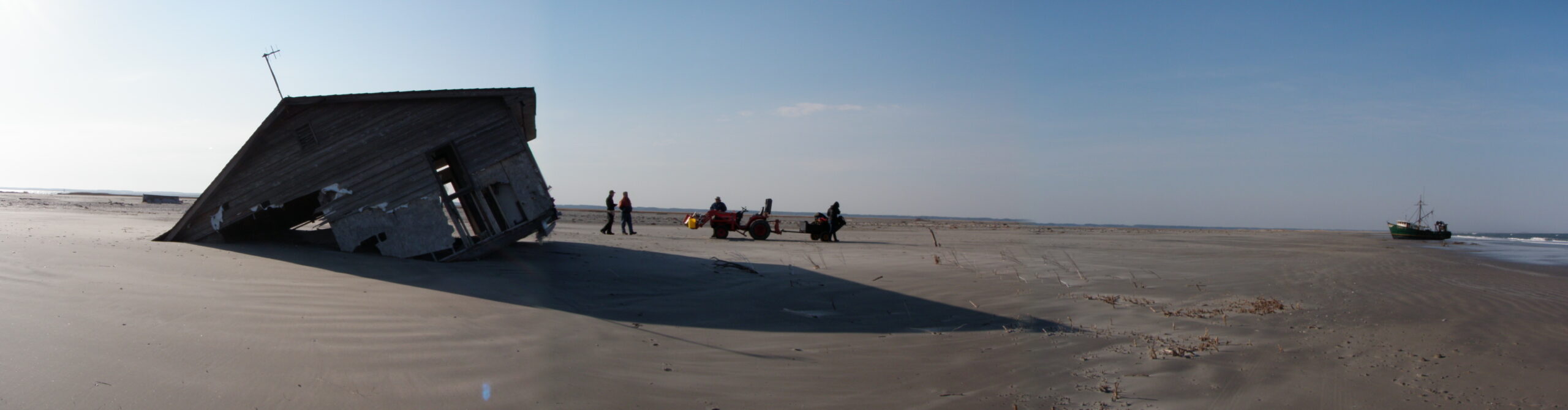
Assessing the effects of management and environmental change on Hatteras Island
The goal of this project is to co-produce science-based assessments of future landscape change under different management and sea-level rise scenarios to provide insight in support of decision-making processes. Our project team includes representatives from Dare County, the North Carolina Department of Transportation (NCDOT) Ferry Division, NCDOT Highway Division, and other stakeholders in the region. (Funded by NC Sea Grant)
Project Summary
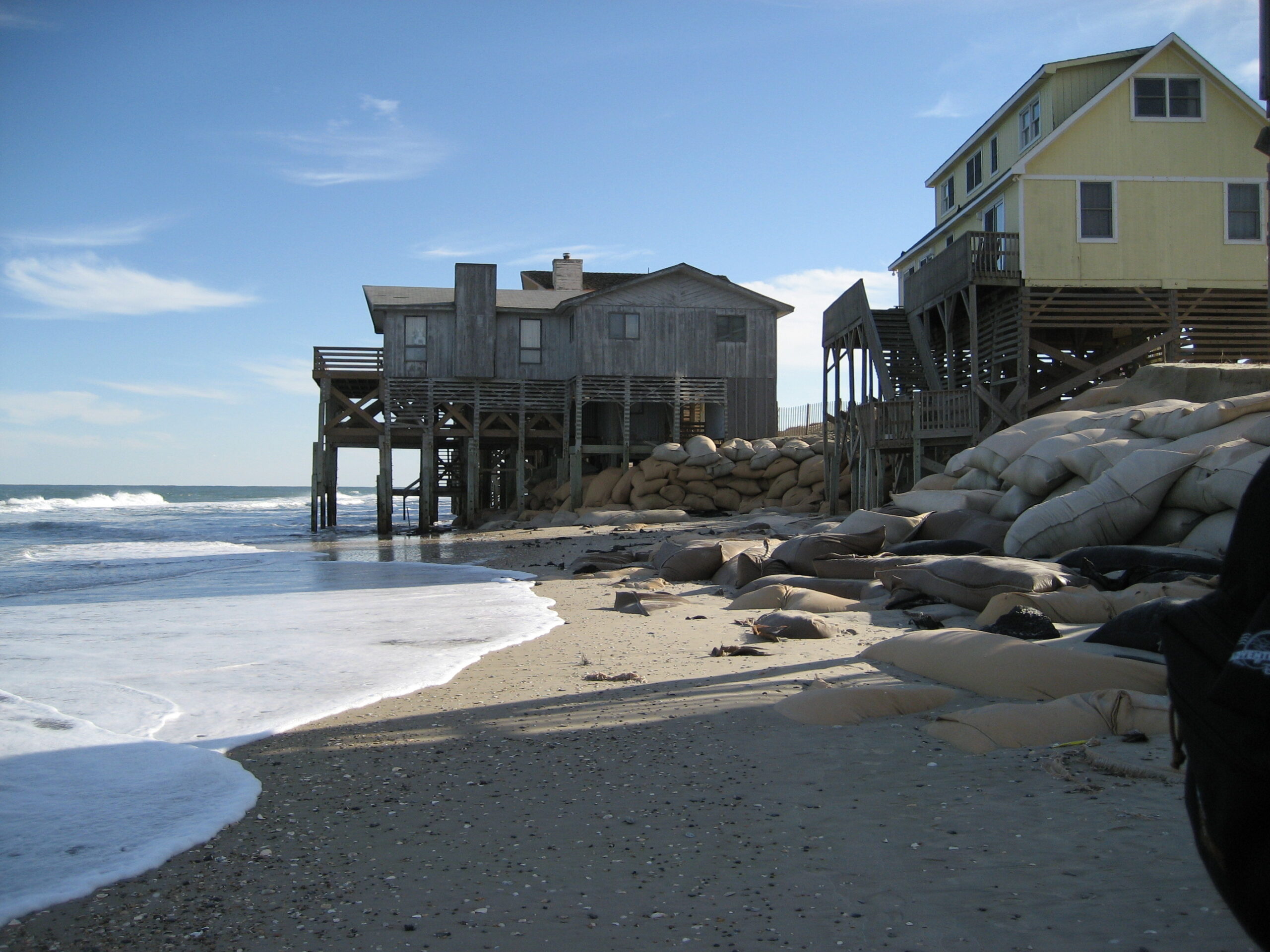
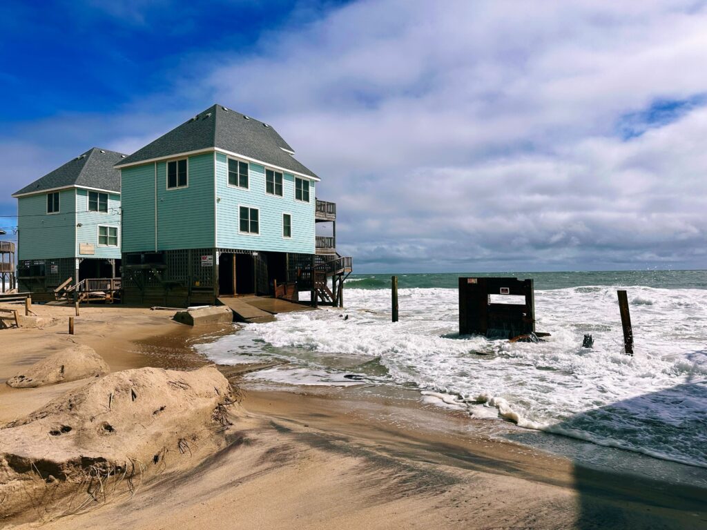
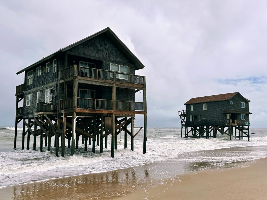
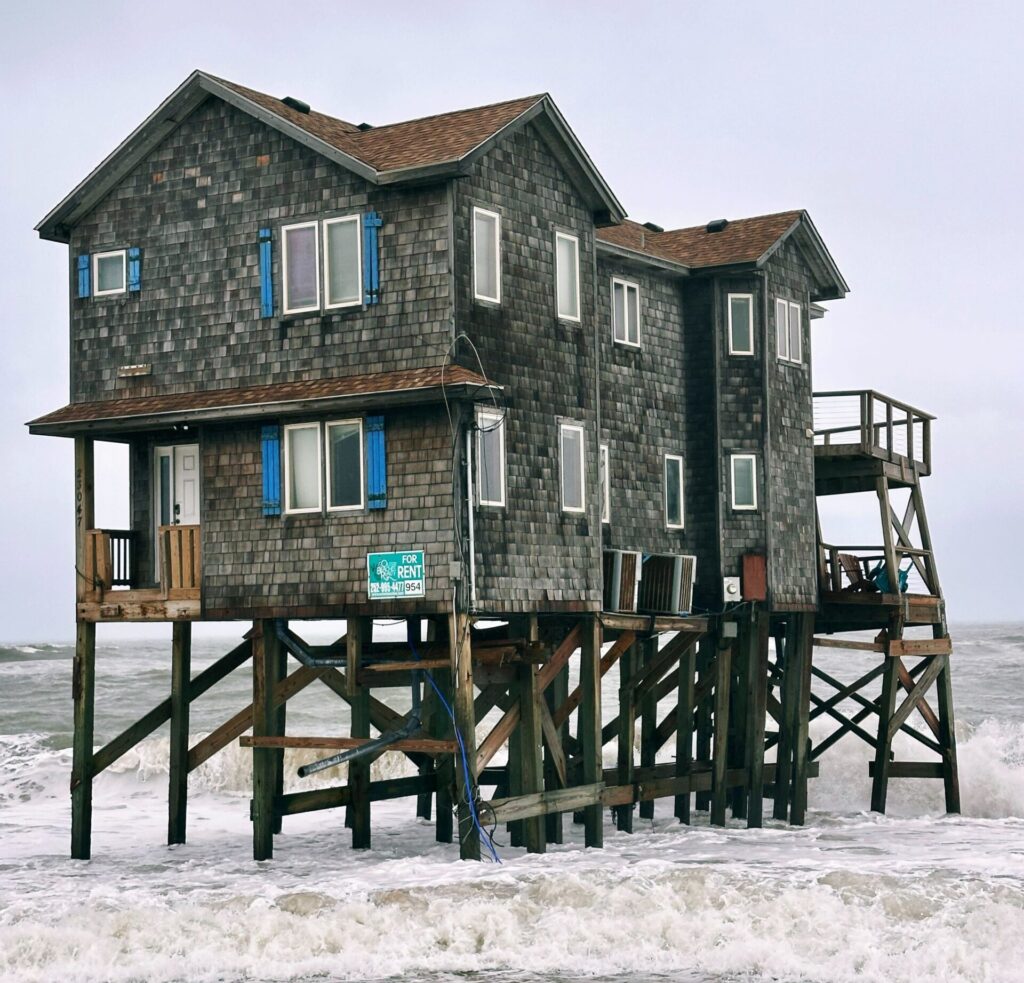
Barrier islands are vital coastal ecosystems that also buffer the North Carolina mainland from storms, erosion, and flooding. Hatteras Island, NC is a 42-mile-long barrier island, which is home to the communities of Rodanthe, Waves, Salvo, Avon, Buxton, Frisco, and Hatteras Village and draws millions of tourists annually to visit the Cape Hatteras National Seashore. However, the dynamic nature of barrier island evolution and the processes that sustain them create complex coastal management challenges. Communities on Hatteras face infrastructure vulnerability and rising costs for management actions like beach nourishment; impacts that will likely become more severe as sea level rises and intense hurricanes occur more frequently in the future.
The communities of Hatteras Island and associated stakeholder groups are urgently seeking to address threatened oceanfront structures in the face of rapid, chronic erosion that has brought the shoreline farther landward over time. A range of management strategies are under consideration, including beach nourishment and groin reconstruction. Understanding how different management actions affect future island characteristics and infrastructure vulnerability, is essential to assessing the tradeoffs involved in different choices. This is especially important because some management strategies, although beneficial in the short-term (years), can be counterproductive, unintentionally leading to lower island elevations and narrower island widths, thereby reducing island habitability in the longer term (decades).
This project is a collaborative effort to evaluate the likely future effects of different management strategies on island width, elevation, position and habitability under different future sea level rise scenarios. By working with project partners—including the National Park Service, Dare County, the North Carolina Department of Transportation and other stakeholders, scientists from the University of North Carolina at Chapel Hill, North Carolina State University, Duke University, and the Water Institute will generate model outcomes to support discussions of management choices, while also advancing our understanding of how human and natural processes interact to shape barrier island futures.
Recent Events
On October 1st, six homes in the Buxton community of Hatteras Island collapsed within 24 hours as hurricanes Humberto and Imelda passed offshore. More homes were lost in the following weeks following the loss of multiple Even storms that remain offshore produce strong winds and large waves, compounding long-term coastal erosion in the region. Over the past five years, 19 homes have collapsed, highlighting the need to assess future risks, community impacts, and management strategies.
More About the Model
- Earth’s Future highlight: https://eos.org/editor-highlights/barrier-islands-are-at-the-forefront-of-climate-change-adaptation
- Anarde, K. A., Moore, L. J., Murray, A. B., & Reeves, I. R. B. 2024a. The future of developed barrier systems: 1. Pathways toward uninhabitability, drowning, and rebound. Earth’s Future, 12, e2023EF003672. https://doi.org/10.1029/2023EF003672
- Anarde, K. A., Moore, L. J., Murray, A. B., & Reeves, I. R. B. 2024b. The future of developed barrier systems: 2. Alongshore complexities and emergent climate change dynamics. Earth’s Future, 12, e2023EF004200. https://doi.org/10.1029/2023EF004200
- Anarde, K. A., Reeves, I. R. B., Hutton, E., Williams, Z., Murray, A. B., & Moore, L. J., 2024c. UNC‐CECL/CASCADE: Release for Earth’s Future Publications: The future of developed barrier systems ‐ Parts I & 2 (Version v1.0.0) [Computer software]. Zenodo. https://doi.org/10.5281/ZENODO.10655831
Coastal dune ecomorphodynamics
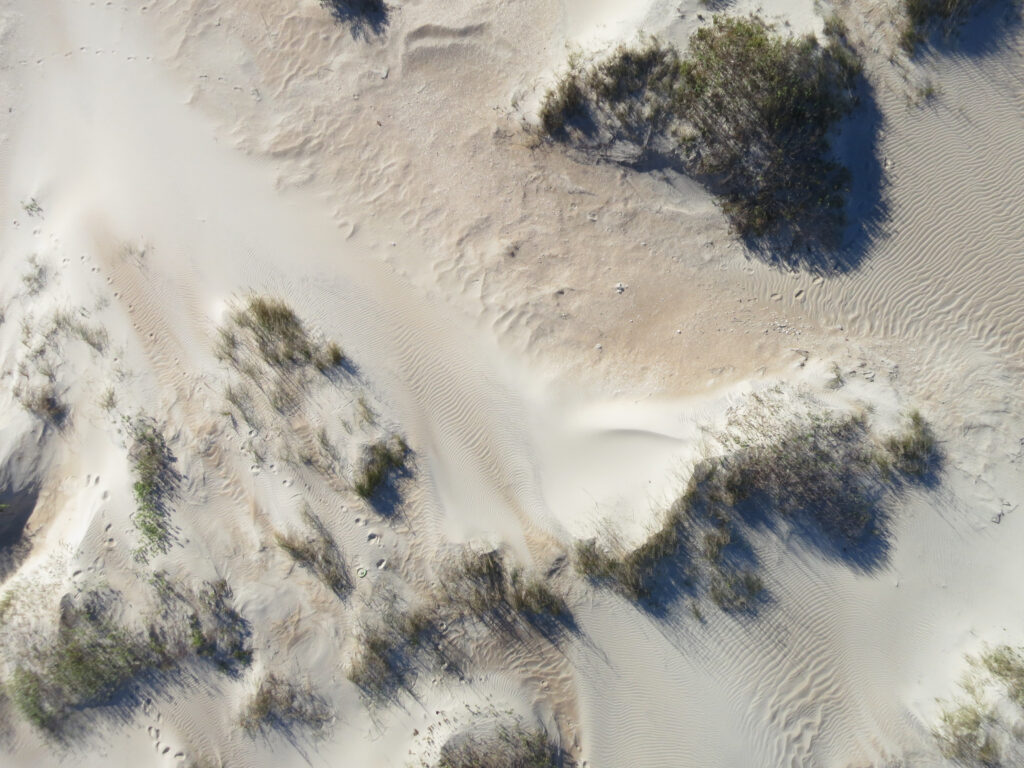
Interactions between sediment transport processes and vegetation processes gives rise to coastal dunes on barrier islands. In this way, vegetation is a key contributor to the development of topographic relief, and influences barrier island susceptibility to overwash processes during storms. Different grass species give rise to dunes of different shapes and sizes. These relationships may change as temperature increases alter the distribution of cool-vs. warm-season grasses.
We use field-based and numerical approaches to investigate the complex, interacting roles of vegetation and sediment transport in shaping island topography, and its influences on island response to sea level rise.
Barrier island response to environmental change

If barrier islands are to persist as sea level rises in the future, they must increase in elevation and shift landward to maintain their position relative to sea level. The ability of islands to stay above sea level, and remain habitable by humans, is controlled by the rate of sea level rise, sediment availability, underlying stratigraphy, back-barrier deposition, and island topography.
We use numerical models to understand the relative importance of these factors and how they may shift over time with environmental changes. Much of this work is inspired by the barrier islands of the undeveloped Virginia Coast Reserve (VCR) home to the VCR – Long-term Ecological Research program.